


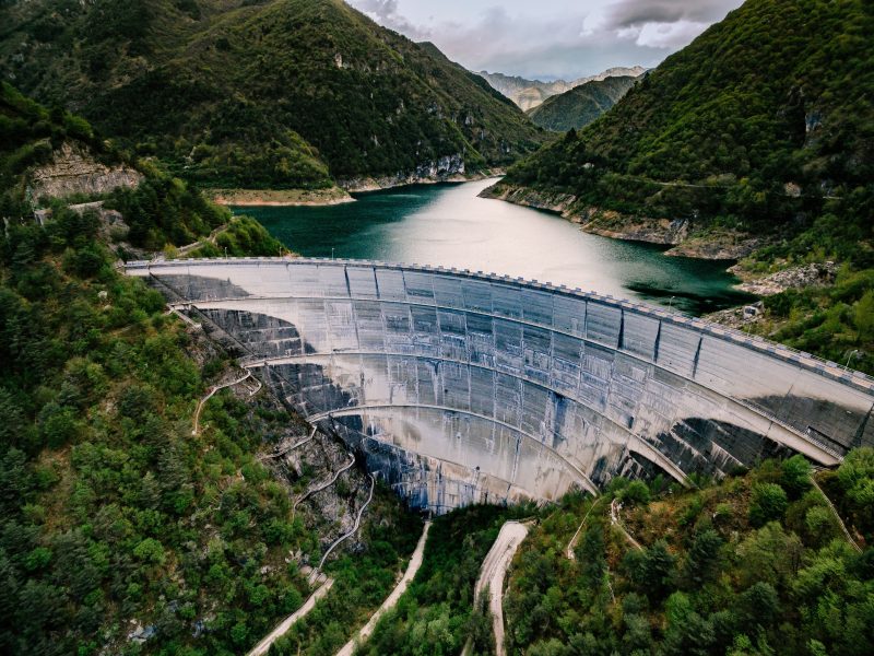


Birdscale delivers advanced Hydrographic and Subsurface Mapping services, combining sonar, LiDAR, GPR (Ground Penetrating Radar), drones, and satellite technologies. Our solutions provide accurate underwater and underground surveys, enabling reliable data for water resource management, civil engineering, and environmental analysis.
Our field-proven services help optimize project planning, ensure regulatory compliance, and reduce risks for complex infrastructure and environmental projects.
Birdscale’s mapping solutions offer high-precision data acquisition and analytics for a range of industry needs
Detailed depth mapping of rivers, lakes, reservoirs, and coastal waters.
GPR-enabled detection and mapping of pipelines, cables, and underground infrastructure.
High-resolution sonar and LiDAR scans for sediment distribution and underwater topography.
Accurate cross-sectional analysis for waterway maintenance and flood planning.
Hydrographic surveys supporting safe navigation, dredging, and marine construction.
Underwater inspection for siltation, sedimentation, and structural safety.
3D subsurface mapping for tunnels, culverts, and underground utilities.
Analysis of aquifer extents, groundwater potential, and recharge zones.
Subsurface data for environmental monitoring and regulatory compliance.
Coastal erosion, shoreline change detection, and tidal analysis.
Our hydrographic and subsurface solutions are trusted by
Multi-sensor mapping for detailed bathymetric and subsurface information.
AI-powered interpretation for rapid, actionable insights.
Comprehensive surveys from planning to monitoring and compliance.
Birdscale’s hydrographic and subsurface mapping services have enabled safe, efficient, and compliant project delivery across sectors.
We use cookies to improve your experience on our site. By using our site, you consent to cookies.
Websites store cookies to enhance functionality and personalise your experience. You can manage your preferences, but blocking some cookies may impact site performance and services.
Essential cookies enable basic functions and are necessary for the proper function of the website.
These cookies are needed for adding comments on this website.
Google reCAPTCHA helps protect websites from spam and abuse by verifying user interactions through challenges.
Statistics cookies collect information anonymously. This information helps us understand how visitors use our website.
Google Analytics is a powerful tool that tracks and analyzes website traffic for informed marketing decisions.
Service URL: policies.google.com (opens in a new window)
Marketing cookies are used to follow visitors to websites. The intention is to show ads that are relevant and engaging to the individual user.
Google Maps is a web mapping service providing satellite imagery, real-time navigation, and location-based information.
Service URL: policies.google.com (opens in a new window)
You can find more information in our Cookie Policy and Privacy Policy.