Aerial Mapping

What We Do
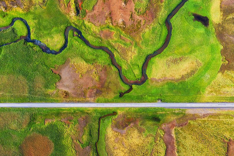
Advanced Aerial Mapping &
Birdscale Spectral Platform
Birdscale provides cutting-edge aerial mapping and intelligence solutions, integrating multiple sophisticated technologies to deliver unparalleled accuracy, detail, and actionable insights. Our advanced multisensor platform is ideal for complex applications across infrastructure, environmental monitoring, agriculture, urban planning, and more.
Detailed Aerial Mapping Solutions & Technologies
LiDAR Mapping – Aerial & Mobile
-
5-Beam Reflectance LiDAR
High-precision, multi-return pulse LiDAR (e.g., RIEGL VUX-120, Velodyne Alpha Prime). -
Helicopter-Based LiDAR
Regal airborne systems for expansive, high-density terrain mapping. -
Terrestrial Mobile LiDAR
Trimble MX9 mobile mapping solutions for detailed road, rail, and urban surveys.
RTK Photogrammetry
-
Real-Time Kinematic (RTK) Drones
Birdscale 's RRTK and PPK drones offering centimeter-level accuracy. -
Gaussian Splatting
Reality Capture and Postshot-based Gaussian splatting for photorealistic 3D models. -
Automated GCP Integration
RTK workflows for enhanced positional accuracy and seamless data integration.
Thermography
-
High-Resolution Thermal Cameras
FLIR Vue TZ20, Zenmuse H20T for precise thermal imaging. -
AI Thermal Analytics
Automated detection of anomalies, hotspots, and equipment malfunctions using advanced AI tools. -
Multi-Spectral Thermal Imaging
Integration of thermal with visible spectrum cameras for comprehensive diagnostic assessments.
Bathymetry & Hydrography
-
Drone-Based Sonar Systems
Echoboat and eTrac autonomous surface vehicles for bathymetric surveys. -
Multibeam Echo Sounders
R2Sonic multibeam sonar for high-definition underwater mapping. -
Advanced Subsurface Imaging
Blue Robotics BlueROV2 for accurate hydrographic and underwater structural surveys.
Multispectral Mapping
-
High-Resolution Multispectral Sensors
MicaSense RedEdge-P and Altum-PT for detailed vegetation and crop analysis. -
Hyperspectral Imaging
Specim and Headwall hyperspectral sensors for precise spectral signature analysis. -
AI-Driven Vegetation Indexing
NDVI, NDRE, and custom vegetation indices via advanced AI analytics.
Satellite Mapping
-
High-Resolution Satellites
PlanetScope, Maxar WorldView-3 for detailed earth observation. -
Synthetic Aperture Radar Satellites
Capella, Umbra SAR satellites enabling cloud-penetrating, day/night imaging. -
AI-Powered Satellite Imagery Analysis
Object detection, change detection, and predictive analytics powered by satellite data.
Synthetic Aperture Radar (SAR)
-
Advanced SAR Satellites
ICEYE and Capella SAR satellites for high-resolution, all-weather earth imaging. -
Interferometric SAR (InSAR)
Precise land deformation and subsidence measurement. -
SAR Polarimetry
Enhanced feature detection and classification through polarization analysis.
Ground Penetrating Radar (GPR)
-
Advanced Subsurface GPR
IDS GeoRadar and GSSI SIR-4000 systems for precise underground mapping. -
3D Subsurface Imaging
Advanced software tools for accurate visualization and interpretation. -
AI Integration
Machine learning-based detection and analysis of underground anomalies and utilities.
SLAM LiDAR
-
Real-Time 3D Mapping
GeoSLAM ZEB Horizon for rapid indoor and outdoor scanning. -
Simultaneous Localization & Mapping (SLAM)
Continuous, accurate mapping without external GPS support. -
Indoor and Underground Navigation
Precise mapping capabilities for tunnels, caves, and complex indoor environments.
Why Choose Birdscale?
Advanced
Technology Integration
Leading-edge sensors, software, and AI analytics.
Precision
& Accuracy
Exceptional detail and accuracy for informed decision-making.
Industry-Specific
Solutions
Tailored mapping and analysis solutions for diverse industry applications.
Trusted by Industry Leaders
Birdscale’s aerial mapping and intelligence platform is relied upon by major infrastructure developers, environmental consultants, and government agencies.


Collaborate with Us.
Let’s work and build
something great together.